April 23, 2020
Margarita Kalinina-Pohl, Michael Duitsman, Fabian Hinz, Anastasiia Nechytailo
As the 34th anniversary of the 1986 Chernobyl [1] disaster approaches, and while most of the world is focused on the deadly COVID-19 pandemic, firefighters and forest rangers have been tenaciously battling wildfires throughout the “Exclusion Zone,” the 19-mile (30 km)-wide uninhabited zone surrounding the Chernobyl Nuclear Power Plant (ChNPP).
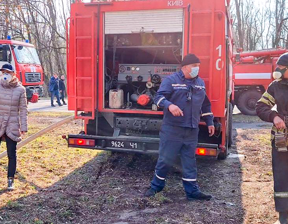
Ukrainian firefighters on the scene. Source: SAUEZM
Fires that began around April 4, 2020, 31 miles (50 km) away from ChNPP did not initially present a major concern, but a sudden flare-up in the forest near the plant raised alarms. On April 11, the New York Times reported that fires threatened to spread to the nuclear plant, which would increase the levels of radiation released by the fire. Ukrainian authorities provided their updates and reports, while Chernobyl tour operators and Russian sources offered their interpretations of the scale of these fires and their proximity to the highly contaminated areas surrounding the ChNPP. On April 14, the State Agency of Ukraine on Exclusion Zone Management (SAUEZM) issued an official statement that the fire was 1.4 miles (2.2 km) away from the ChNPP, but was under control and had caused no damage to the plant. The radiation situation was also reported as normal. But other sources, such as one of Chernobyl tour guides, said that these were “the worst fires,” that the situation was “critical” and that authorities understated the real danger. Furthermore, they claimed that the fires were now only “a kilometer from the station [sic] itself and around 2 kilometers from a site containing radioactive waste.” Referencing Ukrainian sources, independent Russian media outlet Meduza wrote “the fire destroyed part of the Red Forest as well as abandoned villages and the Chernobyl-2 military settlement on its way to the outskirts of Pripyat and the Podlesny nuclear waste dump.” The Meduza report, especially its mentioning of the Podlesny (Pidlisnyi in Ukrainian) nuclear waste storage facility, has raised additional concerns, as this facility contains large volumes of high-level radioactive waste from the 1986 accident.
To examine the credibility of these and other similar statements, the CNS team conducted its own investigation using satellite imagery to analyze and assess the proximity of the fires and fire damage to the Exclusion Zone’s critical infrastructure. A brief overview of the Chernobyl Exclusion Zone and its critical infrastructure will precede this analysis to accurately assess the threats posed by the wildfires.
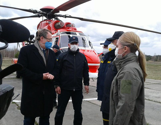
Acting SAUEZM Head Kateryna Pavlova inspecting the fire damage. Source: SAUEZM
The Chernobyl NPP Accident
On April 26, 1986, the explosion and subsequent meltdown of reactor number 4 at Chernobyl Nuclear Power Plant in the Ukrainian Soviet Socialist Republic was the worst nuclear disaster in history, releasing large quantities of dangerous radioactive material into the atmosphere. According to the United Nations Scientific Committee on the Effects of Atomic Radiation, the Chernobyl accident caused the deaths of 30 workers and first responders, radiation injuries to over a hundred individuals, and the relocation of over 340,000 people from areas surrounding the damaged reactor, including, subsequently, from adjoining territories of Belarus and Russia. While the long-term effects of the accident on human health and the environment are still debated, the social and psychological consequences for the hundreds of thousands of people affected by the disaster are undeniable. Experts estimate that the accident released over 100 different radionuclides into the atmosphere, including the especially dangerous iodine-131(with a half-life of about eight days), as well as the longer lasting strontium-90 and cesium-137, which have half-lives of about 29 and 30 years, respectively. Radioactive dust settled into the soil where it was absorbed by moss, tree roots, and other vegetation.
The Chernobyl Exclusion Zone and its Critical Infrastructure
Today, the Chernobyl Exclusion Zone and its infrastructure are managed by the State Agency of Ukraine on Exclusion Zone Management (SAUEZM). The Zone is conditionally divided into two main parts: the Territory of Special Industrial Use, encompassing a 6 mile (10 km) radius around ChNPP, and the Chernobyl Radiation and Ecological Biosphere Reserve, encompassing a 19 miles (30 km) radius of the plant. The former will never be used or inhabited by people again. It houses radioactive waste and spent nuclear fuel storage facilities. The latter was turned into the largest environmental reserve in Ukraine, with more than 400 species of animals, birds, and fish.
The Territory of Special Industrial Use has a cluster of facilities including ChNPP, which was shut down in 2000, three disposal sites—Pidlisnyi, Buryakivka, and ChNPP Phase III— containing large volumes of radioactive waste produced by the 1986 accident, nine radioactive waste temporary localization sites, the industrial complex Vector, and others.
Ukraine received substantial international assistance to address radiation safety at the damaged reactor site and build an on-site long-term radioactive waste storage facility. The $1.6 billion Chernobyl New Safe Confinement (NSC) project included the construction of an arch over the damaged reactor building to seal radioactive contamination. The Vector Industrial Complex includes: a specially equipped, near-surface storage of solid radioactive waste, centralized storage of spent sources of ionizing radiation, and surface storages of solid radioactive waste. Work is underway on the design of a surface storage facility for high-level vitrified radioactive waste—spent nuclear fuel reprocessed by the Russian Federation and sent back to Ukraine for use in nuclear power plants—and a surface storage facility of long-lived low- and intermediate-level radioactive waste.
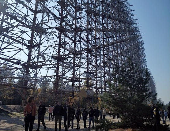
The Duga ballistic-missile warning radar is a popular tourist destination in the Chernobyl Exclusion Zone. Source: Anastasiia Nechytailo
In recent years, the Exclusion Zone has witnessed an influx of both tourists and unauthorized individuals, especially after the popular HBO series Chernobyl and the simplification of the process for accessing the Exclusion Zone. In 2014, the Zone received only 8,404 visitors; by 2017, the number had grown to 49,758. According to the State Enterprise “Center for Organizational, Technical and Information Support of Exclusion Zone Management,” in 2019, the number of visitors skyrocketed to 124,000 tourists alone, not counting those who accessed the Zone illegally. While the surge in this type of “dark” tourirsm is beneficial to tour operators and the local economy, increased human activities in the Zone could also exacerbate a problem endemic to northern Ukraine—forest fires.
The Wildfires
Wildfires began around April 4, 2020, and were believed to have been caused by an intentional grass burn that went out of control. While most of the initial fires were outside of the Exclusion Zone, a new fire appeared on April 8 in the forest southwest of the power plant. By the time the fire was under control, on April 14, it had destroyed a large part of the forest and its inhabiting wildlife southwest of the power plant, alarming Ukrainian authorities and experts with its close proximity to the Zone’s so-called “critical infrastructure,” including the shut-down Chernobyl Nuclear Power Plant and radioactive waste facilities in its vicinity.
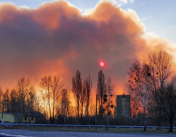
Wildfires burn near the contaminated area. Source: SAUEZM
Through their heroic efforts, Ukrainian firefighters, forest ranges, and SAUEZM personnel averted a low-probability but high-consequence disaster. The forest fires released a small amount of radioactive material into the atmosphere by burning contaminated vegetation. Since the start of fire monitoring, official estimates have indicated several possible short-term increases in the concentration of cesium-137 in the air, but they did not rise above normal. However, had the fire had spread to the power plant and radioactive waste storage sites, the radioactive consequences could have grown enormously.
Fire damage to any of the above-mentioned facilities could have significant consequences. For example, while it may not destroy the NSC structure, an intense fire could break the confinement seal and lead to a potential release of radiation. Fires may also expose facilities containing radioactive waste to the risk of safety breaches. Therefore, accurate, timely, and transparent reporting of fires occurring in the Chernobyl Exclusion Zone is not only important for Ukraine and its immediate neighbors, but for the international community in general as postulated by the Convention on Early Notification of a Nuclear Accident. [2]
CNS Satellite Imagery Analysis of Fires
To assess the potential damage caused by the April fires to Chernobyl’s critical infrastructure, CNS looked at satellite images to analyze the proximity of the fires to facilities in the Territory of Special Industrial Use. [3] The analysis focused on eight sites such as: (1) the Vector Industrial Complex; (2) the abandoned town of Pripyat; (3) Radioactive Waste Disposal Site “Pidlisnyi”; (4) the Chernobyl Nuclear Power Plant; (5) Liquid Radioactive Waste Treatment Plant; (6) Industrial Complex for Solid Radioactive Waste Management; (7) Radioactive Waste Disposal Site “ChNPP-Phase III”; and (8) Interim Storage Facility for Spent Nuclear Fuel. All these facilities are marked accordingly on an interactive map prepared by CNS researchers.
The CNS team used imagery from its corporate partner Planet collected with a near-infrared (NIR) data band. NIR data is very useful for examining vegetation, as shown below.
FULL SCREEN VIEW. Click through the dates to see the progression of the fires and the damage. Click on the numbers to read more about the sites.
Healthy vegetation appears in red, while the area burned or otherwise damaged by the fire appear black. Other colors represent man-made features (buildings and roads) or terrain elements (e.g., bodies of water, beaches, and barren patches of land). Fire damage is much more apparent in NIR imagery than it is in imagery using just the visible spectrum of light.
CNS analysis supports the official statement of the SAUEZM that none of the nuclear facilities or other sites of the Zone’s critical structure were damaged. Although the fire was within the 6-mile (10 km) radius of the Territory of Special Industrial Use, it was stopped at a distance of at least 1.2 miles (2 km) from the power plant. The Pidlisnyi Radioactive Waste Disposal Site, located north of the power plant and east of Pripyat, was at much lower risk, since the fires never approached within 1.7 miles (2.75 km). The Vector Industrial Complex and other above-mentioned facilities were not in the immediate proximity to the fires either. The fires did, however, reach especially close to the town of Pripyat, which has become an infamous tourist destination, with fire damage evident approximately 550 yards (500 meters) away from the town’s southern edge.
Conclusion
These were the largest and the worst fires ever to hit the Chernobyl Exclusion Zone. Planet satellite images, which captured the smoke clouds visible from space, reveal the magnitude of these fires. As of April 22, there were still smoldering patches on the Territory of Special Industrial Use. While the risk of the fire damage to the Chernobyl Zone’s critical infrastructure was prevented, people in Kyiv—about 60 miles (100 km) away—were told to take precautions and keep their windows shut and stay at home. Kyiv today has a grim resemblance to Kyiv in 1986, when Soviet authorities attempted to cover up the disaster and ordered people to stay home with their windows shut. Today, people in Kyiv, like so many others sheltering in place from the COVID-19 pandemic, were already on stay-at-home orders, now further emphasized due to dangerous levels of air pollution from the wildfires raging in near the Chernobyl Exclusion Zone.
Although it has taken a heavy toll on the Chernobyl Reserve and its wildlife, these fires—unlike the 1986 accident—did not cause any serious injuries or deaths to humans. In this instance, COVID-19 quarantine in Ukraine may have prevented injuries and deaths to the Zone’s workers or tourists. The Zone was closed to tourists since March 17. In pursuance of the Presidential Decree to prevent the spread of COVID-19, ChNPP administration reduced the presence of its workers and staff at the plant and headquarters by 2,500, leaving only essential personnel responsible for nuclear and radiation safety of the plant.
The fire has destroyed approximately 30% of the tourist attractions in the Chernobyl Exclusion Zone, including some abandoned villages and a former Soviet youth camp, where first responders to the Chernobyl disaster lived after the accident. Another notorious tourist attraction, a Soviet-built Duga ballistic-missile warning radar, remains standing, but may have been damaged by the fire.
Margarita Kalinina-Pohl is the Senior Program Manager for the Nonproliferation Education Program at CNS. Michael Duitsman and Fabian Hinz are Research Associates at CNS. Anastasiia Nechytailo is a Head of the International Cooperation Department at the State Enterprise “Center for Organizational, Technical, and Information Support of Exclusion Zone Management,” State Agency of Ukraine for Exclusion Management, and a Spring 2020 CNS Visiting Fellow.
Notes
[1] This article uses the Russian and most commonly used spelling, Chernobyl, rather than the Ukrainian variation, Chornobyl.
[2] This Convention was adopted in 1986 following the Chernobyl NPP accident which was covered up by Soviet authorities for two days until Sweden alerted the world about this nuclear disaster.
[3] Buryakivka Radioactive Waste Disposal Site is not on the map because it was not in proximity to the fires.